What is a map? This is a question that was at the front of our minds during our Cartography and Data Visualization class. We developed each of these projects around a key concept that challenged us to reimagine what a map is and how we can visualize its information.
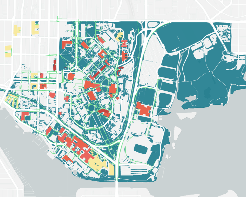
'Campus Map' represents an interpretation of the UW Seattle campus following strong figure-ground cartographic design. This was done in order to break it down to its simplest forms and reveal relationships between campus spaces that aren't initially seen.
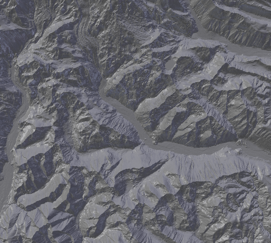
'Remotely Sensed' transforms and transposes both 2D and 3D information into one form by 3D-printing a Raster Digital Elevation Model and applying a 2D Land Type Classification.
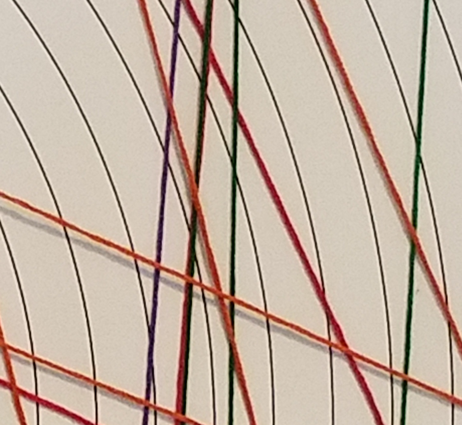
'Mapping the Invisible' takes typically unobserved phenomena and gives it a spatial dimension to illuminate possible relations.
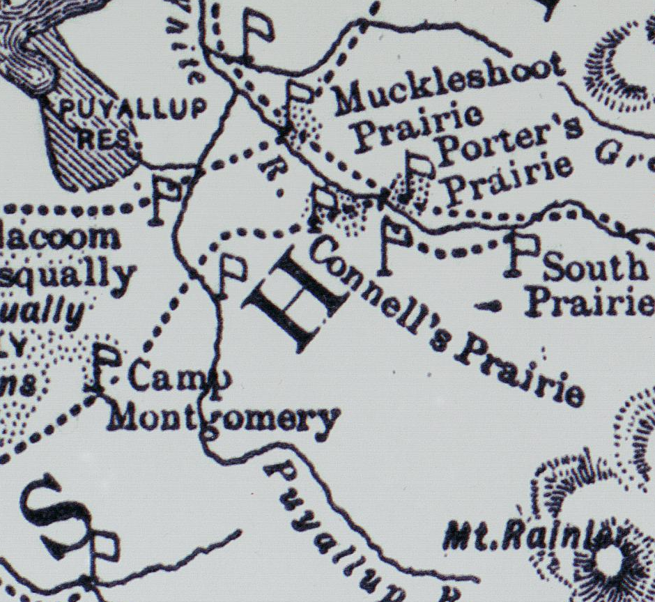
'Mapping a Story' uses sequential spatial points to and historical details to tell a lesser-known story and connect it to the places where it happened.